Tin Bigha Corridor and Dahagram
তিনবিঘা করিডোর ও দহগ্রাম · Patgram, Lalmonirhat, Rangpur
Also known as: Tin Bigha Corridor

- Time needed
- At least 1 day
- Difficulty
- Easy
Are you here now?
Check in when you are at the place. It fills in your travel map and earns points.
About
The Tin Bigha Corridor is a road or strip of land belonging to India on the West Bengal–Bangladesh border which, in September 2011, was leased to Bangladesh so the country could access its Dahagram–Angarpota enclave from the mainland. The enclave remains the only one still in existence after the 2015 resolution of the India–Bangladesh enclaves issue. It is situated in the town of Patgram Upazila. (Source: Wikipedia, CC BY-SA 4.0 — https://en.wikipedia.org/wiki/Tin_Bigha_Corridor)
When to go
- Jan — Best time
- Feb — Best time
- Mar — Best time
- Apr — Possible
- May — Possible
- Jun — Possible
- Jul — Possible
- Aug — Possible
- Sep — Possible
- Oct — Best time
- Nov — Best time
- Dec — Best time
- Best time
- Possible
- Avoid
Costs
No costs have been added yet.
Photos
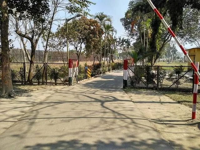
Photo: Salim_Khandoker, CC BY-SA 4.0, Wikimedia Commons

Something wrong or missing?
Prices and rules change. Tell us what you found and help the next traveller.
Questions and answers
Ask before you go; people who have been there will answer.
No questions yet. Be the first to ask.
Posts from travellers
What people who went there wrote and showed.